A three-person NCALM field team was deployed to New Zealand between March 6 and March 24, 2014, to perform an airborne LiDAR survey of five fault segments of the Marlborough Fault System (Eastern Clarence, Western Clarence, Central Eastern Awatere, West Wairau, and East Hope-Conway), on the northwestern portion of New Zealand’s South Island. The project was funded by the National Science Foundation for principal investigator James Dolan from USC who, in conjunction with collaborators Ed Rhodes, Chris McGuire (both from UCLA), Robert Langridge, and Russ Van Dissen (both from GNS Science, New Zealand), are working to understand how regional fault networks distribute deformation in time and space – thus attempting to explain emergent phenomena such as earthquake clusters and strain transients.
NCALM mapped 250 linear km of the fault system with a 1.2 km nominal swath width, and a shot density of ≥ 12 shots/m². This took six flights, with a total flight time of approximately 30 hr (including mobilization from and back to the airplane base in Hastings, NZ). The total laser-on-time (LOT) for the project was 13.4 hr, during which 5.16 billion laser shots were fired. NCALM staff is currently processing the raw navigation and LiDAR data to produce project deliverables.
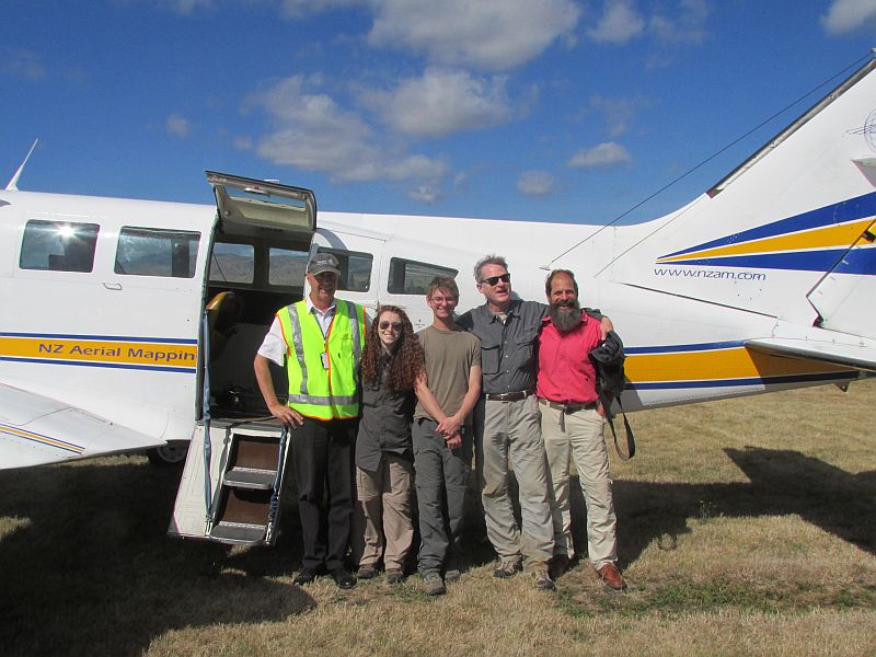
During the last day of flying, project PI James Dolan, his collaborator Russ Van Dissen, and two USC graduate students, stopped by the Blenheim Airport to look at the LiDAR equipment mounted on the airplane, and see a preview of the LiDAR data. The photograph above was taken during their visit. From left to right: NZAM pilot Brian Umbers, Jessica Grenader (USC graduate student), Robert Zinke (USC graduate student), James Dolan (USC), and Russ Van Dissen (GNS Science, New Zealand).