|
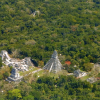
The New York Times – Jacey Fortin The project was started by Pacunam, a Guatemalan nonprofit organization, and carried out with help from the National Center for Airborne Laser Mapping, which is based at the University of… |

|
Ars Technica – Timothy B. Lee Lidar used to cost $75,000. Experts expect this to fall to less than $100. |
|
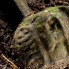
CBS News It's been called the White City, or the City of the Monkey God – a lost ancient city that has fascinated adventure-seekers searching the jungles of Honduras for centuries. Most recently, a… |

|
UH Cullen College of Engineering GSES introduction and overview. |
|
UH Cullen College of Engineering NCALM introduction, overview, recent work, and graduate program. |
|
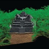
Spektrum Der Wissenschaft – William E. Carter, Ramesh L. Shrestha, and Juan Carlos Fernandez-Diaz Ein LiDAR-Gerät sendet Hunderttausende von Laserpulsen in der Sekunde aus, um von einem Flugzeug aus ein hoch aufgelöstes Profil des Bodens zu gewinnen. Das hilft Archäologen bei… |

|
GeoDataPoint – Linda Duffy "Originally, LiDAR was seen as a means of obtaining elevation data, but there is a growing interest among researchers in accurately mapping water/land interfaces and identifying species by… |
|
Scienceline – Ellie Kincaid High-resolution maps of Earth’s surface reveal archaeological secrets. |
|
American Scientist – William E. Carter, Ramesh Shrestha, and Juan C. Fernandez-Diaz In aircraft flying "low and slow," instruments sending out hundreds of thousands of laser pulses per second can gather enough data to reveal archaeological sites hidden under dense forest… |

|
National Geographic – Douglas Preston (Dave Yoder, Photographs) El Dorado. Atlantis. The Lost City of Z. Legends of such fabled places have enticed generations of explorers into the most remote locations on Earth. Usually they return empty-handed, if… |