
|
University of Houston The latest edition of Expedition: UH takes University Provost Diane Z. Chase to the Cullen College of Engineering's Center for Airborne Laser Mapping to learn more about light detection and… |

|
The UNESCO Courier – Guillermo G. Espinosa The largest metropolis in pre-Columbian America is now yielding valuable information thanks to lidar, a revolutionary laser mapping technology that is opening up new perspectives for… |
|
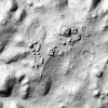
Howtown – Adam Cole & Joss Fong LiDAR scanning is transforming our understanding of the ancient Maya by revealing thousands of hidden structures beneath the forest canopy. In areas like Tikal and Caracol, laser data has… |

|
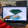
xyHt – John Welter & Adina Gillespie From cities to rainforests to glaciers, the evolving application of airborne mapping technology is transforming how we develop, conserve, and maintain crucial environments across the globe… |
|
CNN – Katie Hunt Three four-hour flights high above the jungles of Campeche on Mexico's Yucatan Peninsula exposed a hidden gem on the ground below: a lost city that was likely abandoned more than 1,000… |

|
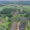
University of Houston – Laurie Fickman "In the ongoing quest to unearth the world's hidden mysteries, University of Houston researchers and archaeology partners have discovered a lost Maya city deep in the jungles of Campeche,… |
|
POB – Emell Derra Adolphus "Hidden in plain sight" is how archeologists described a recently revealed, 3,000-year-old Maya structure at the Aguada Fénix Mayan ruin in Mexico's Tabasco State. The structure is the… |

|
LiDAR News – Adam LeWinter CRREL, in collaboration with the National Center for Airborne Laser Mapping (NCALM) at the University of Houston, has spent the past 6-years iterating on versions of a small footprint… |
|
KOLD News 13 Inomata says his team used laser emitting equipment from an airplane. The laser beams penetrate tree canopies, and the reflections of the ground surface can reveal three-dimensional forms… |
|
Physics – Matteo Rini A remote laser sensing technology is providing unprecedented insights into the society and economy of ancient Maya. |