
|
The Press Democrat – Derek Moore The team flew in and out of Napa County Airport daily to map the area, using sophisticated laser and computer equipment mounted inside a twin-engine Italian-made plane. |
|
The Washington Post – Guy Gugliotta Lidar is a key archaeology tool that can detect not only buildings but also the remains of roads, agricultural terraces, aqueducts, caves, fences and even boundaries between ancient… |

|
BYU Radio Developed countries like Japan and the US have invested millions of dollars in early earthquake detection and warning systems. But scientists at the US Geological Survey and several… |

|
National Geographic News – Douglas Preston In search for legendary “City of the Monkey God,” explorers find the untouched ruins of a vanished culture. |

|
LiDAR News Magazine – Michael Sitar The recent release of an Optech Titan multispectral lidar system breaks away from the traditional lidar paradigm of mere range measurement by exploiting differences in the target's response… |

|
The Antarctic Sun – Peter Rejcek LiDAR survey of McMurdo Dry Valleys to look for melting in the landscape. |

|
University of Houston Dr. Craig Glennie with the University of Houston Cullen College of Engineering discusses a research project seeking to provide first-responders with real-time maps and analysis of disaster… |

|
University of Houston The work being done by NCALM caught the attention of filmmaker Steve Elkins who asked them to map a remote rainforest Honduras that may contain the legendary lost city of Ciudad Blanca. The… |
|
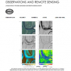
IEEE J-STARS The confluence of the Blue and Colorado Rivers near Kremmling, CO. |

|
The New Yorker – Douglas Preston Our Far-Flung Correspondents: A new scanner’s rain-forest discoveries. |