|
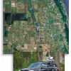
Earth Imaging Journal – Joshua France and Craig Glennie A step-by-step description of a mobile mapping project reveals the tricks of the trade. |
|
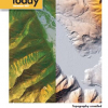
Physics Today Producing surface maps at submeter resolution, even over heavily forested terrain, GLS can reveal the fine structure of such features as faults, landslides, and drainage patterns. |
|
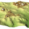
Proceedings of the National Academy of Sciences – Stephen Ornes Laser imaging reveals long-lost traces of ancient civilizations hidden beneath tropical forest canopies. |
|
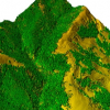
Scientific American – Katherine Harmon Scientists get a three-dimensional Google Earth on steroids, which can penetrate forest canopies, chart sand dune movement, and more, thanks to radarlike lasers. |
|
University of Central Florida A team of UCF scientists use a new lidar sensing system to see through the jungle to explore an ancient Maya city in Belize. |
|
LiDAR News Magazine – Sibyl R. Bucheli, Craig L. Glennie, and Aaron M. Lynne Remote sensing technologies have recently emerged in forensics as a way to investigate clandestine graves and crimes scenes, as methods tend to be both nondestructive and noninvasive. |