News
| NCALM Announces 2019 Seed Proposal Winners 2019 Student Seed Proposal Winners Selected The National Center for Airborne Laser Mapping surveys multiple projects each year for graduate student PIs whose research would be enhanced by… |

|
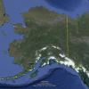
| Call for Expressions of Interest in Alaskan Airborne Lidar Campaign Alaska Airborne Lidar Collection Campaign for Small- and Medium-Sized Projects The National Center for Airborne Laser Mapping is announcing a call for expressions of interest from… |
|
| NCALM at 2019 AGU Fall Meeting National Center for Airborne Laser Mapping/Geosensing Systems Engineering & Sciences Presentations and Posters at 2019 American Geophysical Union Fall Meeting NCALM will be at the 2019… |

|
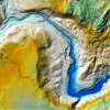
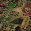
| Three new NCALM datasets released from California and Mexico OpenTopography is pleased to announce the release of three new datasets covering areas of California, and Mexico. Two of the three datasets were collected as part of NCALM's seed grant… |
|
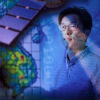
| A Collaboration of Satellites and Villages UH Professor Continues Work With NASA and Mekong River Stakeholders To Address Flooding and Other Critical Issues Hyongki Lee, associate professor of civil and environmental engineering at… |
|
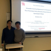
| Donghwan Kim Defends Ph.D. Dissertation River Discharge Estimates Improved Using Ensemble Learning Ph.D. candidate Donghwan Kim successfully defended his dissertation titled, "Ensemble Learning Regression for Estimating River… |
|
| NCALM Announces 2020 Mexico and Central America Airborne Lidar Collection Campaign Mexico and Central America Airborne Lidar Collection Campaign for Small- and Medium-Sized Projects The National Center for Airborne Laser Mapping is announcing a call for expressions of… |
|
| Geosensing Systems Engineering Seeks Postdoctoral Scholar Postdoctoral Scholar Opening A postdoctoral position is available with the Geosensing Systems Engineering & Sciences program in the Department of Civil & Environmental Engineering… |

|
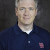
| Geosensing Systems Engineering Faculty Receives $400K Grant from NGA Estimating the Uncertainty in Change-Detection Products will Advance the Geosciences Dr. Preston Hartzell received a $400,000 grant from the National Geospatial-Intelligence Agency (NGA).… |
|
| Geosensing Systems Engineering Seeks Tenure-Track Faculty Geosensing Systems Engineering & Sciences Program Seeks Tenure-Track Faculty for Assistant or Associate Professor The Department of Civil & Environmental Engineering (CEE) at the… |

|